Reading the Sky : How New Automatic Weather Stations Are Protecting Pacific Food, Families, and Futures
May 15, 2026On the low-lying atoll of Abaiang in Kiribati, the margin between a normal day and a dangerous one can be measured in millimetres of rain. On Tongatapu, a fisher heading offshore at dawn is making a decision that depends entirely on weather information they may or may not have. In Samoa, a farmer watching the sky over Aleipata knows the wet season is changing, but until recently had no way of knowing exactly how.
Across these three Pacific Island countries, through the European Union-funded Climate Services and Related Applications (ClimSA) programme, a network of new Automatic Weather Stations (AWSs) is quietly changing their daily decision-making process by putting precise, real-time weather and climate data into the hands of the people and services that need it most.
Why Weather Data Matters for Pacific Food Security
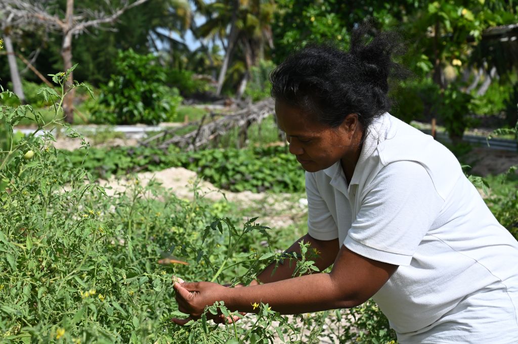
In the Pacific, food security and weather are deeply connected. Root crops, coconut, breadfruit, and fisheries are all vulnerable to cyclones, drought, flooding, and saltwater intrusion. When a farmer loses a taro crop to an unexpected dry spell, or a fisher is caught offshore by a sudden squall, the consequences are immediate and felt by the wider community.
Agriculture and fisheries underpin most livelihoods in Pacific Island countries, where three-quarters of the population lives rurally and relies heavily on these sectors. Around 80% of Pacific Islanders depend on subsistence or smallholder farming for food, while coastal fisheries support over 50% of households with nutrition, income, and cultural value. The difference between a forecast using real-time local data and distant modelling can mean a harvest saved or lost.
An AWS records soil moisture, temperature, and rainfall conditions in real time, that information flows to the national meteorological service and is translated into agricultural advisories and severe weather warnings. Those products reach the farmers and fishers who depend on them for daily decisions about planting, harvesting, and heading out to sea.
Technology Built for the Pacific
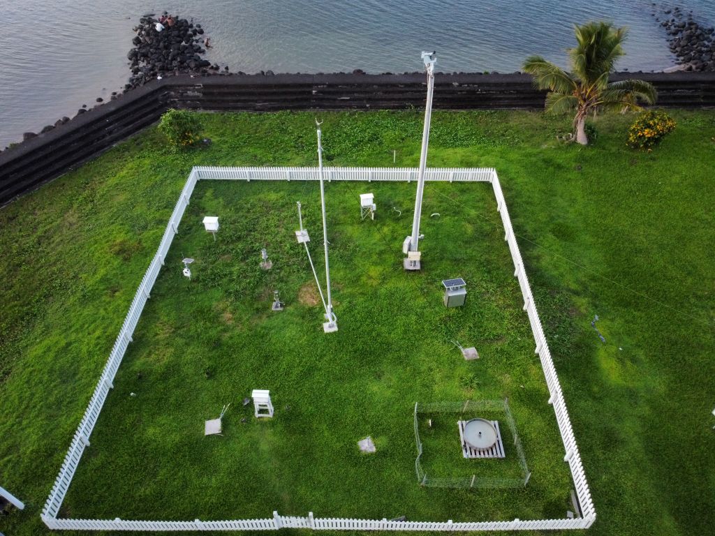
An Automatic Weather Station looks very ordinary, with just a solar panel, a mast and a cluster of sensors. But what it delivers is anything but ordinary. Each station measures air temperature, humidity, wind speed and direction, rainfall, atmospheric pressure, solar radiation, soil temperature, soil moisture, and air quality. These datasets are captured every minute of every day, without the need for anyone to be physically on-site.
The stations run entirely on solar power with a 14-day battery backup, and transmit data via cellular or satellite link. If the cellular network drops during a cyclone, the system switches to satellite automatically, meaning nothing is lost and nothing is delayed. That data flows to each country’s national Meteorological Service in real time, feeding into forecasts, warnings, and the global observation systems that underpin international weather models.
Three Countries, One Mission
The agricultural value of this data is significant. Soil sensors at depths of 10, 20, 30, and 100 centimetres track moisture and temperature in the root zone where crops grow. Solar radiation and sunshine duration sensors measure the energy driving plant growth. Combined with rainfall, humidity, and wind data, this gives met services the information they need to issue planting advisories, drought alerts, and irrigation guidance that is grounded in measured, local conditions rather than regional estimates.
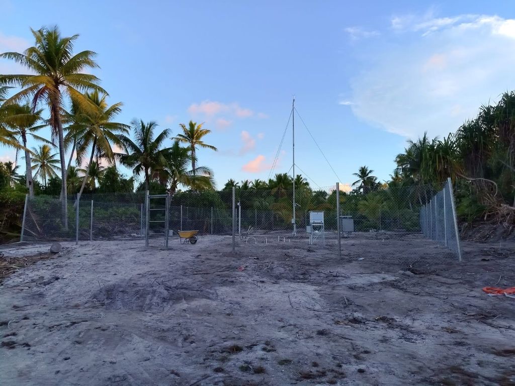
In Kiribati, the ClimSA programme is providing three new Automatic Weather Stations, procured and installed by contractors Earth Sciences New Zealand (ESNZ). The latest of these has just been commissioned at Tuarabu Airport on Abaiang, a milestone for the Kiribati Meteorological Services and for the islands’ observation coverage. Four additional stations are already operational on Maiana, Marakei, Abemama, and Nonouti, with equipment for Kuria, Nikunau, and Abaiang installations underway. The expanded network is transforming Kiribati’s ability to monitor conditions across the widely dispersed Gilbert Islands, where previously entire island groups could go without a single operational station.
For a country where most atolls sit barely two metres above sea level, accurate localised forecasts are a matter of survival. The data also supports copra and breadfruit farmers who rely on seasonal rainfall patterns, and fishing communities making daily decisions about whether conditions are safe to head offshore.
In Tonga, ClimSA is providing four new Automatic Weather Stations. Two have been installed, one at Fua’amotu International Airport in the vicinity of the main runway and another at the new Tonga Meteorological Service (TMS) office at Matatoa. The remaining two are planned to be installed Ha’apai and Vava’u islands with the actual site location to be confirmed, which will further expand the current real-time automatic weather station coverage and network of Tonga into the outer islands.
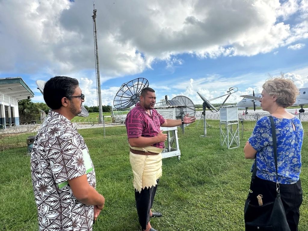
Director of Meteorology Laitia Fifita recently welcomed the EU Ambassador for the Pacific, Her Excellency Barbara Plinkert, to the TMS offices, where he outlined the positive impacts that the new stations are having on forecast quality, operations and early warning capability. To highlight, one of the stations being installed has the capability of detecting and analysing air quality in Tonga. An enhanced feature of the automatic weather station supported and funded by ClimSA that makes their services more efficient and supports effective decision making and planning.
The stations form part of a broader suite of 11 ClimSA-supported activities in Tonga, including drought preparedness, climate data rescue, strengthened community early warning systems, and training in agriculture and maritime safety. For Tongan farmers managing root crops and livestock through increasingly unpredictable wet and dry seasons, the soil moisture and temperature data from these stations provides the evidence base for better agricultural planning.
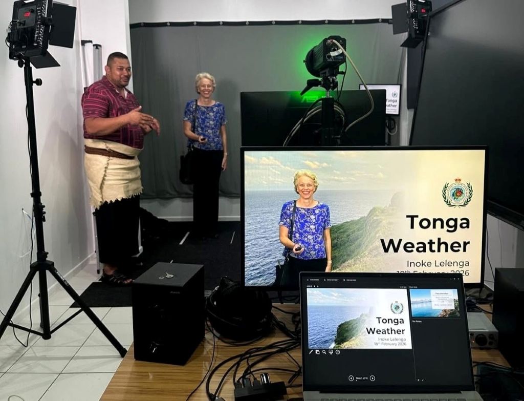
In Samoa, ClimSA is providing four new AWS, with eight stations now operational across Upolu and Savaii. The programme also funded the installation of three AWS previously purchased through the Green Climate Fund, addressing a critical gap where equipment had been procured but lacked the resources for deployment.
A further 10 existing weather stations have been refurbished with new sensors and automated rain gauges, restoring capacity that had deteriorated over time. The Samoa Meteorological Division is using the expanded network to sharpen forecasts and strengthen community early warnings. For Samoa’s agricultural sector, the soil temperature and moisture sensors at multiple depths are providing subsurface information that was previously unavailable, and now helping farmers decide when to plant, when to irrigate, and when to hold off.
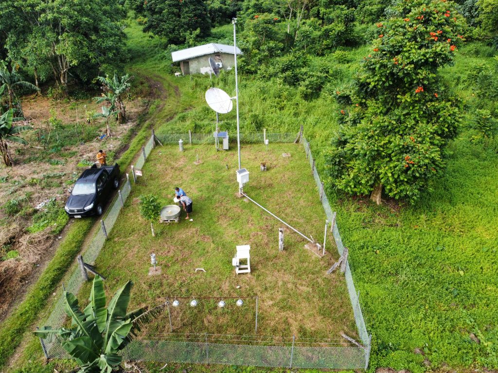
A Pacific Investment
The AWS programme represents an investment of nearly USD 700,000 by the European Union through ClimSA, delivering 11 new stations across three countries: four for Samoa, four for Tonga, and three for Kiribati. Every station was designed to a single standard specification developed collaboratively by the World Meteorological Organisation’s (WMO) technical staff, ClimSA, national met service representatives, and the technical contractor ESNZ, ensuring consistency and interoperability across the region.
The investment was designed as a complete package, not just equipment. It included a two-week training programme at the ESNZ facility in Christchurch, New Zealand, where two technicians from each country (six in total), undertook hands-on training linked directly to factory testing and installation procedures. Those trained technicians then led installations in their home countries after ESNZ conducted a pilot installation in each location. The package also covered all installation costs, including funding to secure and prepare each AWS site, and a full set of spare parts for every country to ensure long-term operational sustainability.
All 11 stations measure identical parameters to WMO standards, ensuring data is comparable across the region and feeds into the WMO Information System (WIS 2.0). For three countries that have historically struggled with sparse, ageing observation networks, the impact is tangible: more stations producing higher-quality data means more accurate forecasts, earlier warnings, and stronger evidence for the climate adaptation decisions that affect food production, water security, and community safety.
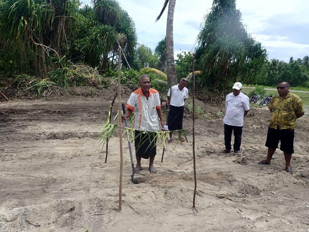
What the technical specifications do not capture is how these stations are installed in the culturally rich and diverse Pacific landscape. Across the Pacific, communities allocate prime land for the installations, which is cleared with care to minimise environmental disturbance.
Before a single sensor is mounted, permission is sought from traditional landowners, and in many cases a ground-breaking ceremony is held to honour the land. It is an act of welcome, carried out as if seeking the land’s blessing to bring modern instruments into a space that has been read by traditional knowledge for generations. Technology does not replace that knowledge, but compliments the generations of traditional knowledge.
Three countries, one network and a Pacific that honours its past while being better prepared for what nature concocts.
